Showing posts with label River Great Ouse. Show all posts

Wednesday, 25 December 2013

Christmas floods on the busway

Merry Christmas to all readers of the busway blog!

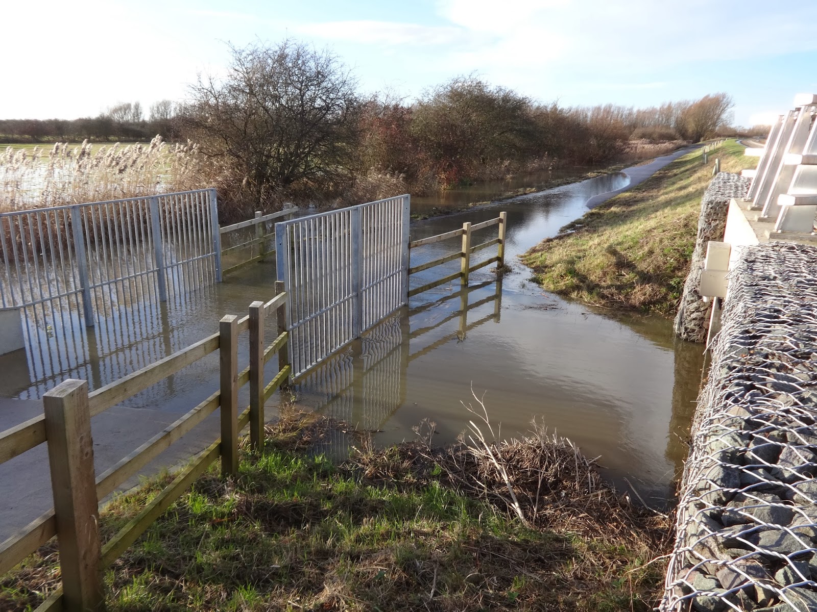
It's not such merry news for those of us who cycle the busway. I walked along the busway between the gravadlax and the turkey early this afternoon, and the Great Ouse River is in flood. Water is now covering the busway cycle track at the concrete bridge a short distance east of the Ouse Viaduct. I was a bit surprised to see that the water is flowing through that concrete bridge from north-east to south-west ( that's left to right on the first photo, and right to left on the second).


I'll keep checking the water levels over the next few days and post details on the blog.

Boxing Day update - the big dip between St Ives Park & Ride and the Ouse Viaduct is now under water, and the flooded section beyond the viaduct has extended both directions from the concrete bridge. So probably 400 metres of the cycle track under water.


Update - 7 January.
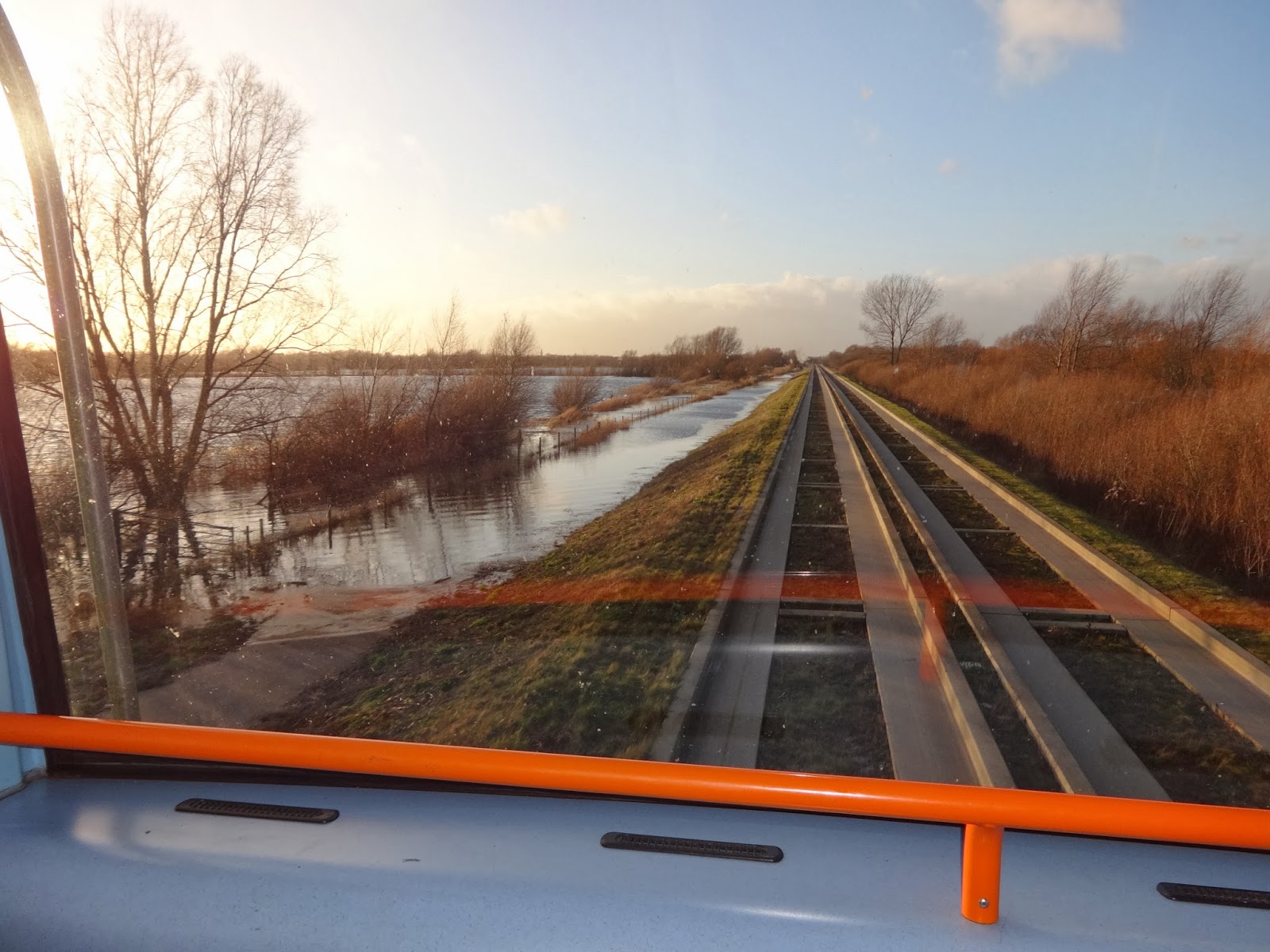
This photo shows the flooded cycle track between Fen Drayton and Swavesey.

Update 9 January.

I walked along Low Road towards Fenstanton this afternoon and here is the state of the road at Crystal Lakes. Although the road is 'closed' several cars drove through the flood apparently without difficulty and a cyclist made it through.


Monday, 18 March 2013

Cycle track flooded yet again

The River Ouse has risen a lot today ( Monday), and as a result the busway cycle track is now under water near the concrete bridge just east of the Ouse Viaduct.

Tuesday 19 March - flood water in the dip between St Ives Park & Ride and the Ouse Viaduct


Friday, 15 February 2013

More flooding - 15 February

The River Ouse has burst its banks again and the busway cycle track is again under water on either side of the concrete bridge between St Ives and Fen Drayton.

So far the first dip (nearest to St Ives Park & Ride is OK), but the flood water is starting to encroach on the path there.

Wednesday, 5 December 2012

Earith flooding

As users of the busway, and readers of this blog, will be aware, the recent flooding of the main road through Earith caused huge traffic queues in St Ives which affected the punctuality of busway services. This is a regular feature of life in this area unfortunately, and happens once or twice a year whenever the River Ouse is in flood.

Today's Hunts Post ( 5 December, page 7) prints several letters  urging the County Council to build a causeway or bridge at Earith that will ensure the road is never under water.

On page 9 of the Hunts Post (5 December) is an article outlining previous attempts to build a causeway at Earith. It seems they were rejected for reasons such as - the floods were only 2-5 days a year, or  a causeway would impede water flowing out into the Ouse washes.

Friday, 23 November 2012

Busway cycle track flooded

Today (23 November) the cycle track is flooded for about  200 metres  east of the Ouse Viaduct.

The heavy rainfall of the last few days in the Great Ouse's Northamptonshire and Buckinghamshire headwaters is likely to reach St Ives over the weekend, so I'd expect the water level to rise even further.

The busway cycle track seems to me to be susceptible not so much to the amount of local rainfall, but to water coming down the river from its huge catchment area after periods of heavy rain. I think the river authority tries to control the flow of water by using the section between St Ives Lock and Brownshill Lock (Earith) to hold water back, probably in order to minimise closure of the main road at Earith Bridge.  I think we need to campaign for having the cyle track through the floodplain raised by another meter or more.

Wednesday, 7 November 2012

Cycle track flooded - again

The cycle track that runs alongside the busway was flooded this morning -  from the Ouse Viaduct eastward for about 300 metres to just beyond the concrete bridge over the flood water conduit. For mist of that stretch, the track was only partly covered with water, but near the small bridge there was water right acreoss the track. This seems to be the lowest point on the cycle track and is the first section to flood when the river level rises.

The track was passable - but if the water level riseslater  today, there could be problems for cyclists.

Tuesday, 1 May 2012

Busway cycle track flooded

Following the recent prolonged rainfall, the River Great Ouse has burst its banks and is flooding the water meadows near St Ives. As a result a section of the busway cycle track is under water. This morning, around 6.30, the dip between St Ives Park & Ride and the Ouse Viaduct, was just above water level, by a margin of maybe 20 cm.
Across the viaduct, the cycle track is under water.
I walked along the busway this evening about 6.30pm. The water level had risen and the cycle track is now flooded in the dip between the Park & Ride and the Ouse Viaduct. Despite that I saw a couple of people cycle through the flooded section.
Since this morning, a warning notice has been put up.
And the not-very-effective Flood gate had been closed.